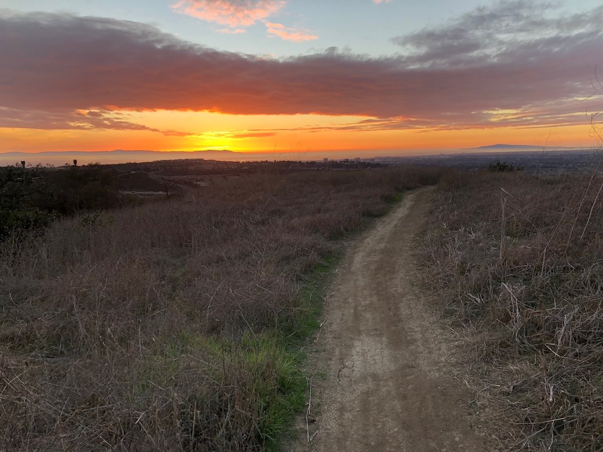
Walk to the end of Shady Canyon Drive and you'll find the Quail Hill Trailhead, a 2.8-acre lot that marks the start of the Quail Hill Loop Trail. Two miles, natural surface, open every day from dawn to dusk. It's an easy loop, the kind you can do before work, and it's the only wilderness trail in the entire Irvine Ranch Natural Landmarks system that allows leashed dogs. Most residents who live near that trailhead treat it as the whole story: a pleasant loop, a good place to walk the dog, done.
It isn't the whole story. It's the lobby.
Behind that loop sits a preserve of more than 5,200 acres, protected since Irvine voters approved the Open Space Initiative in 1988. Most of it is not available to you on a Tuesday afternoon no matter how good your hiking boots are. The City of Irvine's own trail maps split this network into two colors: white trails, open daily for self-guided use, and yellow trails, restricted to docent-led programs because of sensitive habitat. The single-tracks that wind through Shady Canyon and neighboring Bommer Canyon, the ones with the views and the rock formations people actually want to see, fall almost entirely into that yellow category. The gate at the end of your loop trail leads somewhere. You just don't get to walk through it whenever you want.
The trailhead you have is better than the one next door
Here's a detail that doesn't show up in the generic trail write-ups: your trailhead has longer hours than the neighboring one. The Quail Hill Trailhead is open from 6 a.m. to 10 p.m. The Bommer Canyon Trailhead, the other main approach into this same network, closes at 6 p.m. If you're the kind of person who likes an evening walk after the sun goes down in December, or an early loop before a 6:30 flight out of John Wayne, Quail Hill's access point is functionally the better front door to this entire system, not just to its own two-mile ring.
That matters because the interesting terrain, the parts worth the trip, sit past both trailheads on the same connected network. Getting there on your own schedule is not really an option. Getting there at all runs through one of two mechanisms.
The one Saturday that unlocks everything
Once a month, generally the third Saturday, the Irvine Ranch Conservancy runs what it calls a Wilderness Access Day. For a window of roughly five or six hours starting at 8 a.m., every single-track trail in the southern Open Space Preserve opens for self-guided hiking and biking, including the ones in Shady Canyon and Bommer Canyon that are locked the other twenty-nine or thirty days of the month. No registration required, though the Conservancy will hand you a map if you register online first. Park at the Bommer Canyon Cattle Camp, and be off the restricted trails by the posted cutoff or you're risking a citation on your car.
On that one Saturday, the names that only exist in trail descriptions become real: Shady Oaks, Butterfly Valley, Monkey Flower Mesa, East Fork, Rabbit Run, Fox Run. East Fork is the one locals warn you about, a steep quarter-mile climb that gains 300 feet before it lets up, but it puts you at Hogback Ridge, which is the payoff. If that sounds like too much, Ridge Route gets you to the same overlook on a gentler grade. Rabbit Run and Fox Run are narrower, rockier, the kind of single-track you scramble down and up rather than walk.
Don't confuse this with the separate Cattle Camp Open Access, which also happens on the third weekend but covers Friday through Sunday and only opens the renovated picnic grounds, not the trail network. One is about a barbecue pit and a sycamore canopy. The other is about East Fork and Hogback Ridge. Same weekend, different product, and it's an easy mix-up if you're going off a calendar invite someone forwarded you.
Three Sisters sits inside the locked zone
There's a sandstone formation in the preserve called Three Sisters, three rock outcrops weathered down to near-identical shapes, sitting right at the junction of Shady Oaks, Butterfly Valley, and Monkey Flower Mesa. It's the photo everyone who does eventually get back there ends up taking. The reason you don't see more of those photos from casual weekday hikers is structural, not aesthetic. All three trails that meet at that junction are yellow-zone. You either catch the monthly access window or you book a guide.
The docent shortcut most residents skip
The Wilderness Access Day is not actually your only way in. It's just the one that requires the least planning. The Irvine Ranch Conservancy runs a full calendar of docent-led programs through letsgooutside.org, and several of them start from trailheads a five-minute drive from Quail Hill.
The Super Trek combines the Quail Hill and Shady Canyon trails into a single guided route, up to nine miles with roughly 2,000 feet of elevation gain, moving at about three miles an hour. It's demanding, but it's also open on a schedule you can plan around rather than waiting for a single Saturday.
There's also a guided mountain bike ride that stitches together nearly every trail name mentioned above into one loop: it climbs West Fork Trail out of the Cattle Camp to the top of Bommer Ridge, drops into Lizard Trail through riparian habitat, climbs again to Serrano Ridge, descends Camarillo Trail to the Nix Nature Center for a water stop, then continues to the Cattle Crest trailhead and rides Cattle Crest into Shady Oaks. That's a route most residents would never assemble on their own, guided or not, because half of it sits behind the same yellow-trail restrictions.
For something lower-key, there's a fitness hike on Hicks Haul Road, a paved 3.5-mile out-and-back to the top of Loma Ridge with panoramic sunset views across the county. It moves fast, usually wraps in about an hour, and because the return often lands after dark, the Conservancy specifically asks hikers to bring a red-tinted flashlight.
Access Point | Cadence | Distance / Effort | What It Actually Opens |
|---|---|---|---|
Quail Hill Loop Trail | Daily, dawn to dusk | 2 miles, easy | The loop itself, and the only Landmarks trail open to leashed dogs |
Wilderness Access Day | Monthly, generally the third Saturday | Self-guided, any level | Shady Oaks, Butterfly Valley, Monkey Flower Mesa, East Fork, Rabbit Run, Fox Run |
Cattle Camp Open Access | Third weekend, Friday through Sunday | None, picnic grounds only | Renovated Cattle Camp picnic area and parking, not the deeper trails |
Super Trek | Periodic, via letsgooutside.org | Up to 9 miles, 2,000 ft gain | Combined Quail Hill and Shady Canyon singletrack, docent-led |
Guided mountain bike ride | Periodic weekday evenings | Multi-trail loop | West Fork, Lizard Trail, Serrano Ridge, Camarillo Trail, Cattle Crest, Shady Oaks |
Hicks Haul Road fitness hike | Periodic evenings | 3.5 miles paved, about 1 hour | Loma Ridge sunset views |
The Cattle Camp is the hinge
The restored Cattle Camp deserves its own mention because it does double duty. Covered by a sycamore canopy and rebuilt with a rustic but modern layout, it now includes a 15-acre event space with a stage and backstage room, available for private rental for weddings, company picnics, and family reunions. On its own third-weekend schedule it's a picnic destination. On Wilderness Access Day it's also the parking lot and staging area for the trails behind it. It's the one piece of infrastructure that shows up on both calendars, which is probably why it gets confused for the whole system when it's really just the front porch of it.
If you're quiet on any of these trails, particularly early or late in the day, you'll likely see more than the terrain. Red-tailed hawks work the ridgelines, roadrunners cut across the paths, and mule deer show up in the surrounding brush. None of that requires a special day. It's just easier to notice when you're not rushing to beat the cutoff.
What this actually means if you live here
The practical takeaway isn't complicated, but it's not obvious either until someone lays out the calendar. Living at the Quail Hill Trailhead gets you daily, dog-friendly access to a genuinely nice two-mile loop with longer open hours than the trailhead next door. It does not, by itself, get you to Three Sisters, Hogback Ridge, or the single-tracks that make this preserve worth talking about beyond the loop. That takes either one Saturday a month, marked on the Irvine Ranch Conservancy's calendar, or a docent-led booking on letsgooutside.org that runs on its own schedule year round. Most people who live two minutes from all of it never make that distinction. Now you can.
If you're weighing a move into Quail Hill, already call it home, or you're curious how this pocket of Irvine compares to the coastal canyon and hillside communities nearby, Jacqueline Thompson specializes in Quail Hill real estate in Irvine, California.